Celebrating 50th birthday on the trail
Continue reading
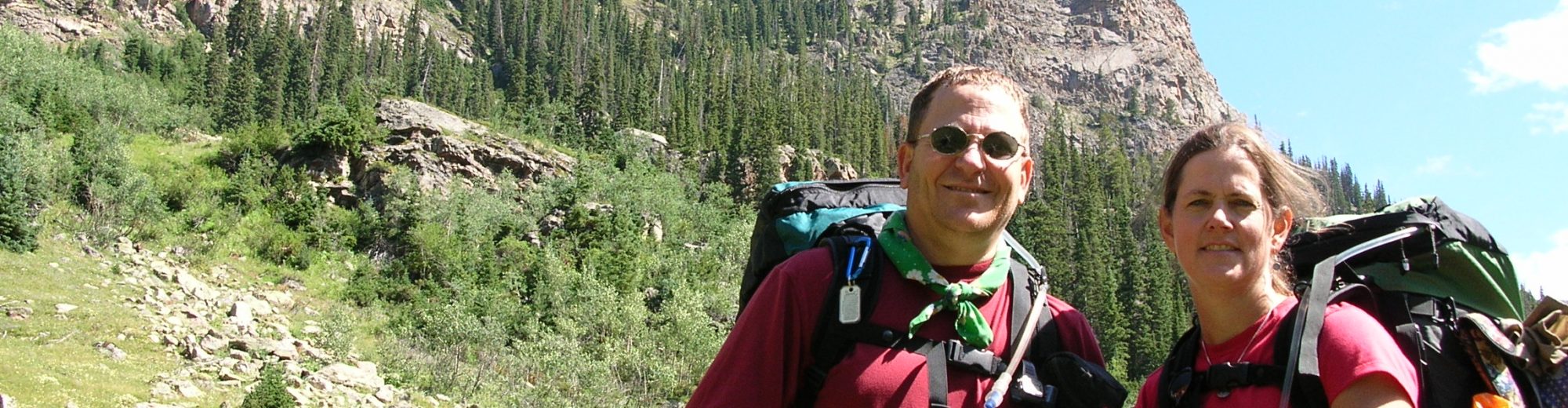
PCT-Timberline to Columbia Gorge, OR August 2005
Leave a reply

An epic trip around Mt Rainier with lots of up and down each and every day. The views were stunning and worth the effort.
Continue reading
Every good plan is subject to change. We had to make big modifications to our original plan based upon water levels and weather.
Continue reading
A backpacking trip report about a counterclockwise backpacking trip around Mt Hood Oregon. On this trip were Ed Tucker, John Gundry, and me (Carl Fisher).
We stayed in a motel on the 7th in Portland OR and got up at 5:00am and on the road to Mt. Hood at 6:30am. Timberline Lodge, our starting point, was achieved at 7:30am and we were able to hit the trail at 8:15am. The first part of the trail was downhill so we made really good time before crossing two ridges and two major streams with no bridges.
Ed had to put at least one foot in each stream and was the start of his trail name “Splash”! The day ended at a site near the intersection of the Timberline Trail and Elk Meadow at an elevation of 5720 feet. The temperature for most of the day was in the 50’s and very comfortable.
Camp was set up and dinner eaten by 6:00pm. I was tired from both the physical exercise and lack of sleep the night before. We were all in the tent and our bags by 8:00pm and asleep by 8:30. I slept through the night until 5:00am when my feet got cold.


Since we are all early risers, we were up at 6:00am and on the trail at 7:30am. All uphill until 9:00am for 1000 feet and there is 400 feet more to go. Fortunately, this will be the high point for the day and the trip. The soil / trail has been very sandy with lots of rocks. Real fun on the footing! We made it to the high point at 10:00am and asked someone to take our picture with the cairn marking the spot with Mt Hood in the background.

As would be expected we kept on hiking, mainly downhill, until we reached Cloud Cap, our intended destination for the evening. Since it was only 11:45am we agreed to keep going and made it all the way to Elk Cove. We camped right alongside a stream (a big no-no) but very handy for getting water and cleaning up. Our camp was only about 5 feet off the trail (another by no-no). This was my first back to back big mileage days!
The temperature is in the low 40’s when we hit the trail at 8:00am but quickly rose to a comfortable 60’s. There were excellent views all day long of Mt Adams, Mt Saint Helens, and Mt Rainier. A long break seemed the right thing to do at Carin Basin where there were numerous campsites and a stone building. This would have been an excellent place to stay but there was still a lot of day left.
We skipped Eden Park to cut 0.6 miles off the entire trip. Prior to getting to Bald Mountain we decided to cut about a mile off the trip by going cross country, up a watershed and then down the other side, a hike of about 100 yards. This put us on the Pacific Crest Trail. Two miles down the trail we came up to Muddy Fork River which was washed out by a mud slide the previous year.
The power of the mud slide was incredible as evidenced by the 100’s of old, mature trees strewn about like matchsticks. Needless to say – getting across this ¼ mile stretch was challenging but fun! We had to hop from boulder to boulder which had been placed by the mud slide like so many grains of sand.
The night was spent on a sandbar of the Sandy River. Before getting to the Sandy River we spent about an hour at Ramona Falls – a 50 foot waterfall nestled right off the trail. The area was cool and refreshing.


Today was billed as a “butt kicker” by John and it lived up to the billing. Our plan was to make the first major ascent (2100 feet) and about 3 miles and to assess the time and how we felt to determine if we were going to continue. Amazed, we reached this point at 10:00am feeling strong so we made the decision to push on to the car. From this point on we gained another 1000 feet, mainly in the sun with temperatures approaching 80 degrees. We got to the car at 2:30pm.


A backpacking trip to the desert. A warm change from the cold weather in Green Bay, WI. We brought rain to the desert.
Continue reading
This backpacking trip was to the Porcupine Mountain State Park in the upper peninsula of Michigan. The four of us, John Gundry, Ed Tucker, John Phelps, and me (Carl Fisher) departed early from work on a Friday for the four drive to the trailhead. The drive was uneventful as was the short 1 mile backpack to our campsite for the night.
We hiked 5 to 7 miles on the second day, about 1/2 way around Lake of the Clouds with comfortable temperatures in the 50’s and beautiful and colorful scenery. We got to see fall in all its glory.
The final day, Sunday, was an easy five ish miles back to the car for the drive back to Green Bay WI.


Carl, Ed, John, and Mark flew from Green Bay WI to Phoenix AZ on an uneventful flight. Tim met them at baggage claim and the group proceeded to the parking lot of Tim’s office where we proceeded to fill water bottles, fuel bottles and to pack the backpacks for the trek. After a brief, but bumpy, ride down a dirt road we arrived at the trailhead. No problem parking – no cars for miles. So it was with high hopes and even higher spirits that the group of five began the trek that they would soon refer to as “The Mazatzal Death March”.

The saga begins at 5:00pm with a gentle uphill climb on an even dirt path. Upon reaching the top, the tread changed from dirt to fist sized rocks, loosely strewn on the ground every 4 to 6 inches. When stepped upon, these rocks move increasing the chance for a twisted ankle and blisters.
Fortunately, no twisted ankles but blisters were to play an important role in the trek. The next two miles were relatively flat with a slight downhill slope. After hiking for 1.5 hours we selected a spot to make camp for the night. Finding level ground without cactus and rocks was tough. The three tents were pitched very close together.

Supper was spaghetti which ended up being burned to the bottom of the pot, fortunately it did not destroy the flavor.
We were up with the first light, something that happens every day. Spirits are still high. After a hot breakfast of oatmeal, Mark discovered a scorpion crawling on his pack. Our planned route today takes us to the intersection of the Verde and East Verde rivers, a descent of 2600 feet and a hike of 8 miles. Footing remained treacherous throughout the day and by noon Carl and Tim were doctoring their feet liberally with moleskin.

The temperature was in the 80’s and the group thought they had plenty of water and planned to replenish water supplies at one of the 4 stock tanks shown on the map. Doubt began to creep into our minds when the first tank was dry. “Maybe the Forest Service ranger was incorrect” thought Carl “when he told us water shouldn’t be an issue.” After the fourth dry tank, open discussion about the planned route occurred but the best option was to continue forward.
There was no better sight than the lush Verde River valley. Yes, there was water and pools large enough for swimming. By this time we had been using the map long enough to make the connection between the term “hardscrabble” on the map and the treacherous rocks we had been negotiating all day long. For comparison purposes, walking on loose sand by the river was easier than the hardscrabble.

We woke to a clear morning with nice temperatures. However, Carl and Tim’s feet were a mess. Both had significant blisters and did not want to walk today. A group decision was made to stay put for the day since we had a nice campsite on sand right next to the Verde River. Mark, John, and Ed went for a hike while Carl and Tim stayed in camp. Swimming in the Verde River was refreshing.

Our plan was to hike out by a different, fifteen mile route. However, the lack of water on the way in AND Tim and Carl’s blisters led to disagreement. Should we stay on plan and take a chance of no water on the long route or stay with the way we came in and carry a lot of water uphill? After much discussion we set a deadline of 5:00pm. Stand on one side of a line drawn in the sand to return via the known route or the other side to stick with the plan. Fortunately for Tim and Carl the decision was made to return on the shorter, known route.

An uneventful hike out. Upon returning to Tim’s white mini-van we discovered that it was covered with dark marks and slobber. We speculate that the nearby cows mistook his white van for a salt lick! Since we came out a day early we headed for Flagstaff where Tim’s family had a condo that we were able to crash at, clean up, and get a nice meal at a nearby restaurant.
Tim actually had bloody toes and lost 2 toe nails a week after returning from the trip (thankfully no pictures to show). The trip is now referred to by the participants as “The Bloody Stump March”.

Rain, Rain, Rain. A long weekend trip where rain was the main event. Lots of learning for two inexperienced backpackers about how to keep the inside a tent dry (we didn’t, but we learned).
Continue reading
The first backpacking for four guys that worked together at desk jobs. While there were mishaps along the way no one was seriously injured and the trip started lasting friendships and launched many more trips.
Continue reading